Texas Ecological Systems Mapping Project — Pecos River Extension
Proposal
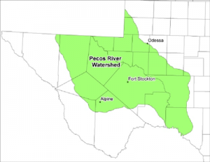
Texas Parks and Wildlife proposes to create a seamless database/map of the Pecos River Watershed contained within the State of Texas. This objective will be accomplished by extending the boundaries of the current Texas Ecological Systems Database Project to include the western portions of the Pecos River Watershed as defined by USGS 8 digit Hydro-logic Unit Codes.
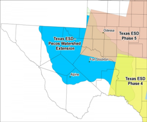
Texas Ecological Systems Database Project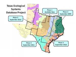
Texas Parks and Wildlife Department is cooperating with private, state, and federal partners to produce a new land classification map for Texas, based on the NatureServe Ecological System Classification System as described by Comer (2003)1. The basic steps are to identify mapping targets using ecological systems as a starting point, collect data from air photos and the field to implement a supervised classification, and use ecoregions, SSURGO soils, DEM-based variables, and hydrology to help interpret the ecological meaning of final mapping targets. Rapid collection of field data was accomplished by combining ecological expertise with GIS data collection techniques. Improved thematic and spatial resolution is achieved using a decision tree classifier with both remotely sensed and abiotic variables, map objects generated at 10 m resolution, and the modeling of mapping targets using ecological site descriptions from SSURGO soils and data from the NatureServe systems classifications.
Ecological systems represent sets of geographically juxtaposed communities that share similar ecological processes, substrates, and/or environmental gradients. Ecological systems may occur at a variety of scales. Ecological systems must be stable for 50 years or more. These non-hierarchical, associations may occur in multiple systems.
Methodology
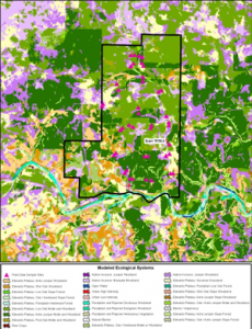
Remote sensing-based land cover was developed by applying a regression tree classifier to three dates of Landsat TM satellite imagery and ancillary information including: slope, aspect, landscape position, solar isolation, canopy cover, and impervious cover; plus cropland from FSA Common Land Units. The regression tree approach allows for the inclusion of continuous (satellite image reflectance) and categorical data into the classification process. The final classification was rendered by summarizing the classified data under a set of image objects that were developed from 10m NAIP county mosaics.
Final mapped land cover types (Mapping Subsystems) are made as precise as possible by combining the results of the moderate-resolution remote sensing-based analyses with other information, such as ecoregions/geology, hydrology, county-level mapped soils, and slope. For example, “Deciduous Forest” from remote sensing analyses may be mapped as “Oak / Hardwood Slope Forest” if it is found on Adobe Ecological Site Types, >20% slope; or as “Floodplain Hardwood Forest” if found on floodplains; or as other cover types if found on other site types, soils, or ecoregions. Historic vegetation patterns can also be discerned from the modeling data, and can thus be used to infer vegetation dynamics and management options in the contemporary landscape.
Field data was collected adjacent to public roads and on public lands.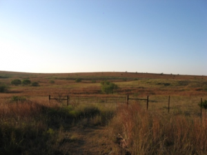 Data was collected on private lands with written landowner permission. Minimum site spacing is 1 mile, except for rarely encountered systems which are mapped as encountered. Sites are 1 hectare and a minimum of 30 meters from road edge. Samples document vegetation in the tree, shrub and herbaceous strata. Data collected includes top 3 species per strata, percent cover in each strata, ecological system and land cover class.
Project Deliverables
- Spatial Database of Ecological/Mapping Systems for the Pecos River Watershed
- Spatial Database of Historic/Potential Distribution of Ecological Systems based on SSURGO Soils data for Pecos River Watershed
- Spatial Database of Landcover in Pecos River Watershed
- Interpretive book of Ecological/Mapping Systems for Pecos River Watershed
- Scientific descriptions of Ecological / Mapping Systems for Pecos River Watershed
- Spatial Database of Field Collected Vegetation / Ecological Systems Training and Verification Sites
Project Costs
| Activity | Cost |
| Remote Sensing / GIS Data Processing | $225,000.00 |
| Ground Data Collection Costs | $ 35,000.00 |
| Total Project Costs | $260,000.00 |

